
It’s a light pollution map!
I’m not sure what you’re looking for.
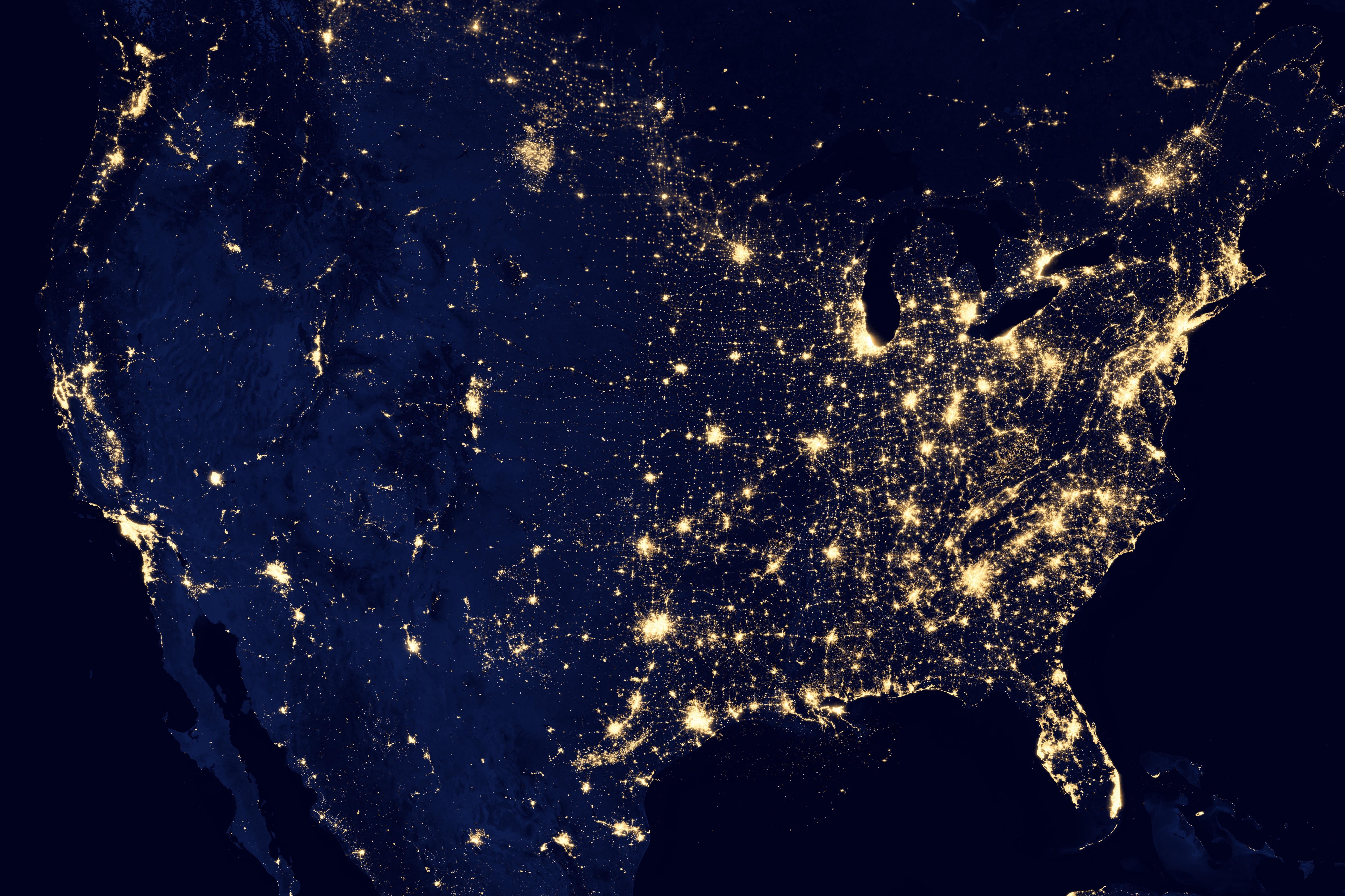
This is a composite satellite image of nighttime light sources.
I can’t think of anything unifying other than “satellite image”.
Thanks
Looks like a jpeg to me
I think it needs more jpeg
Satellite image at night.
Nighttime satellite light map?
Thanks
I named it Gerald.
The community is called No Stupid Questions but apparently it does have stupid answers.
Okay in all seriousness, this kind of comment is not helping the asker at all.
Maybe not, but it apparently helped mildly amuse significantly more folks than it pissed off so I’m happy with it.
To me it looks more like a Bertha.
My understanding is that’s literally what a big chunk of North America looks like at night, when viewed from space with a sufficiently long camera exposure. This specific image may be composed of many exposures, but it’s not a cartogram or something; it’s a composite photograph.
Mostly you’re seeing electric lighting, which is clustered around places where people live and have the resources to light up their buildings and streets – so that people can see, drive, and be safe at night.
It kinda shows the dominance humans have over the planet. We affect nearly every part of it. Nearly everything is light up by our lights.
To the point where it’s visible from space. From space, it’s as if we have altered all of the night’s topography.
Thanks
Looks like a planning map for high speed rail to me
idk, a light map? you trying to Google it? or just for the trivia knowledge?
!solved
Unsolved?
What color is this dress?
Black and gold
Don’t get me started, it white and…!
If you’re talking data viz, maybe a dichromatic chloropleth geo chart or a hot spot/density map?
satellite map.
Baaabbbaaaa yeettuuuu yeettuuuu leeeyyaaaiiie… 🎶
Crazy how sparsely populated the US is west of Dallas, TX.
It’s mostly desert and mountains


